Application of Advanced Technologies in the Production of 1:25,000-Scale Exploration Maps for the Onshore Sector of the Southern Caspian Basin
Excutor of project: Dr. Mohammadreza Ghasemi
Year: 2026 (1405)
Application of Advanced Technologies for Producing 1:25,000-Scale Exploration Maps in the Onshore Area of the Southern Caspian Basin
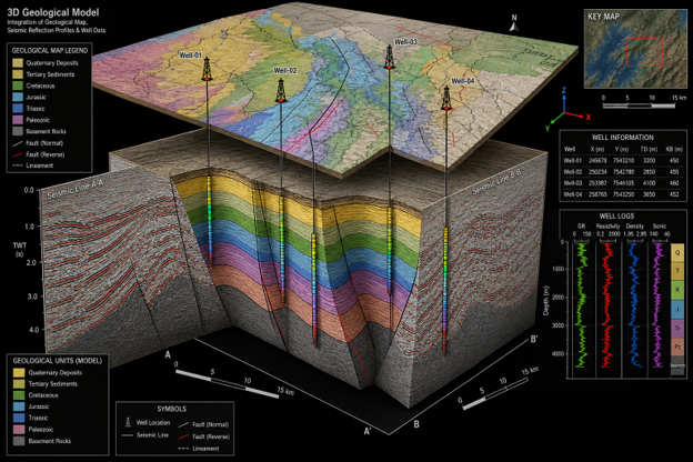
The research project "Application of Advanced Technologies for Producing 1:25,000-Scale Exploration Maps in the Onshore Area of the Southern Caspian Basin" aims to improve the methodologies used for preparing geological exploration maps and to enhance their effectiveness in oil and gas exploration.
The project will begin with the development of a comprehensive database of modern geological mapping techniques, with particular emphasis on specialized methods employed in hydrocarbon exploration. These methods will then be evaluated in terms of accuracy, reliability, practical efficiency, implementation time, and cost-effectiveness to identify and adapt the most suitable approach for Iran's geological conditions.
In addition, the project will investigate the role of artificial intelligence technologies in improving the accuracy, speed, and quality of field data collection and the production of geological exploration maps.
Subsequently, several 1:25,000-scale geological exploration maps will be produced using the selected methodologies for the onshore sector of the Southern Caspian Basin, covering parts of Mazandaran and Golestan provinces. These maps will undergo accuracy assessment and validation under the supervision of the project client.
Finally, the project findings will be consolidated into a comprehensive technical report, including the optimized methodology for producing geological exploration maps and the associated technical specifications and implementation guidelines.
Sending comments for this product is not allowed.