Applied Geology Research Group
Related Professors: Dr. Mohammad Reza Ghasemi, Dr. Morteza Khalatbari Jafari, Dr. Mehdi Mohammadi Vizheh
Introduction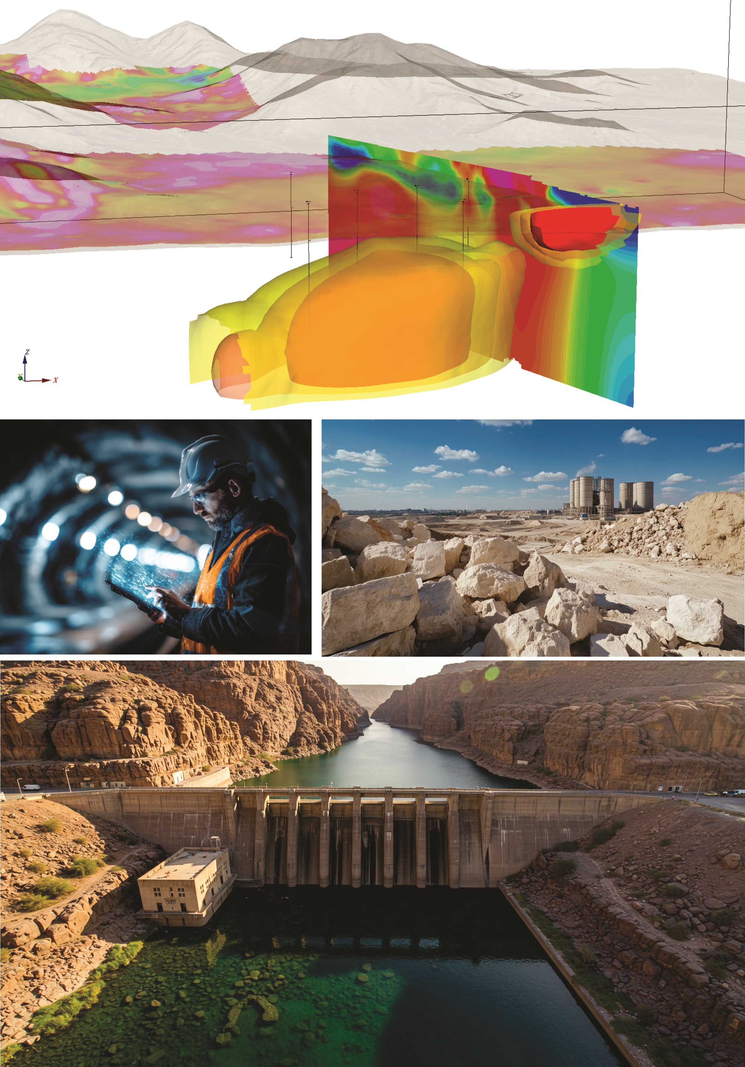
Applied geology is the knowledge of applying the principles, concepts, and methods of earth sciences to solve practical problems in the fields of resource exploration, engineering, environment, and development planning. This branch of geology is a bridge between basic earth sciences and the technical and economic needs of society, which, by focusing on the study and analysis of geological conditions, seeks to provide solutions for the safe and sustainable exploitation of earth resources and the reduction of natural hazards. This group, relying on various sciences such as engineering geology, hydrogeology, geotechnics, petroleum geology, environmental geology, and remote sensing, investigates and models the behavior of earth materials and formations in the face of human projects.
Tasks and Objectives of the Applied Geology Research Group
- Study and assessment of geological hazards: such as earthquakes, landslides, subsidence and floods, and provide risk reduction solutions.
- Rock and soil mechanics; Study of physical and mechanical properties of rocks and soils for civil projects such as dams, tunnels, large structures and mines.
- Hydrogeology and water resources: Exploration, management and protection of groundwater resources, investigation of aquifer contamination and design of monitoring systems.
- Engineering and geotechnical geology: Conducting basic and detailed studies for foundation design and construction of structures, slope stability analysis and land improvement.
- Petroleum and energy geology: Study of reservoir formations, source rocks and cap rocks, analysis of oil traps and assessment of hydrocarbon potential of sedimentary basins.
- Environmental geology: Remediation of soil and groundwater contamination, waste disposal site location, and environmental impact assessment of mining and industrial activities.
- Applied geomorphology and land use planning: Study of landforms and their shaping processes for land use planning, urban development, and watershed management.
- Remote sensing and geographic information systems (GIS): Processing and interpretation of satellite images and geographic data to prepare thematic maps, monitor environmental changes, and support decision-making.
- Geological data modeling and simulation: Using geostatistical methods and specialized software for 3D subsurface modeling, uncertainty analysis, and design optimization.
- Empowering students and researchers: Through participation in applied and field projects, and familiarization with modern standards and methods of study.
- Development and application of advanced methods: in the fields of exploration geophysics, drilling, sampling, and in-situ and laboratory experiments.
- This research group aims to meet the specialized needs of industry and society by training specialized personnel and producing technical knowledge in vital areas of applied geology.