


Morphometric analysis and tectonic morphology of active structures in the Central Zagros
Executor of project: Dr. Hamid Nazari
2018
This research which done in Fars area in zagros simply folded thrust belt focused on faults and their relation to folding by presenting a new update and combination of structural date.
The studied area is limited by main recent fault trending NW-SE in north, Razak fault in east and Ghatar - Kahrizak fault system in its westward. This study is based on pre existing data such as Geological map in 1:250000 and 1:100000, digital elevation models from SRTM and ASTER Topographic maps as well as satellite images (STOP and land sat).
We used a largely also ArcGis, ER Mapper, Global Mapper, Mrsid, Envi.
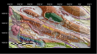
In the first step, 160 topographic profiles prependicular to the folding axes allowed us classified folds in A. B and C classes in term of symmetric or asymmetrical folding.
Asymmetrical antiform could be related to the blind faulting or a surface faulting with steep dip in the limb of anticline satellite image also allows us to have good estimation about Geometry and Kinematic of the faults a part of the results of this study is present in form of four maps in scale 1:800000 and its relevant report in 577 pp.
ارسال نظر برای این محصول مجاز نیست.